

Studying Pacific-Centered World Maps and Pacific Islander Navigation
Studying Pacific-Centered World Maps and Pacific Islander Navigation
World maps are posted on the walls in classrooms everywhere, but the orientation of maps are usually seen in a format where the Pacific Ocean and the Pacific islands are split to the ends of the map. Tupaia (too-pah-ee-ah), a high priest and navigator from the French Polynesian island of Ra'iātea (rye-eh-ah-teh-ah) defied this norm when he created a famous map centralized on the South Pacific as he sailed with Captain James Cook on the Endeavour. In this lesson, students will discuss their thinking about world maps that are centered on the Pacific Ocean, learn about Tupaia and his map, and create their own map of a place that is important to them.
Lesson Objectives:
Interpret maps using the map keys and other features
Compare common world maps and Pacific-centered world maps
Describe who Tupaia was and the significance of his map
Create their own world map
This lesson plan kit includes:
Video Links
Resources Links
Canva Slides
Discussion Guides
Activities Templates
Essential Questions:
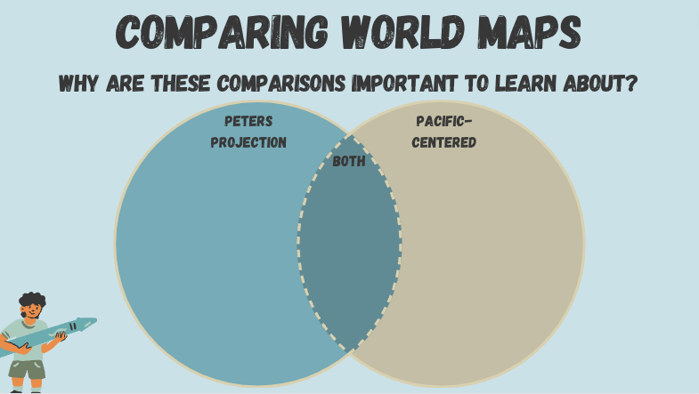
What are similarities and differences between a common world map and a Pacific centered-world map and why are these differences important to learn about?
Who was Tupaia and how does learning about his map help you make your own?
Slideshow Preview


The standards covered in this lesson are: HSS 2.2, HSS 3.1, CCSS.ELA.W.3.7
Lesson plan created by Leiana Talo Lepule in partnership with OCA-Asian Pacific American Advocates
